
Battlefield Maps - Western Front
 This section of the website reproduces large-scale maps categorised by battlefront covering the key battles and offensives fought from 1914-18.
Specifically, this page contains maps illustrating the course of the war fought on the Western Front.
The sidebar to the right lists each map category available within the section. Click here to view an introduction to the map series.
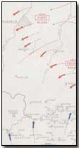
Three versions of each map are available - standard, large and very large. Generally standard files possess a resolution of 800x600 (approx. 70KB); large files 1600x1200 (approx. 140KB) and very large files 4000x3000 (approx. 550KB).
| Map Name | Description | Standard | Large | Very Large |
|---|---|---|---|---|
| German Invasion of Belgium | Situation at 20 August 1914 |
|
|
|
| Battle of the Frontiers | Situation at 22 August 1914 |
|
|
|
| Battles of Mons/Sambre | Situation at 23 August 1914 |
|
|
|
| First Battle of the Marne (1) | Situation at 26 August 1914 |
|
|
|
| Battles of Le Cateau/Guise | Situation at 26 & 29 August 1914 |
|
|
|
| First Battle of the Marne (2) | Situation at 30 August 1914 |
|
|
|
| First Battle of the Marne (3) | Situation at 2 September 1914 |
|
|
|
| First Battle of the Marne (4) | Situation at 5 September 1914 |
|
|
|
| First Battle of the Marne (5) | Situation at 9 September 1914 |
|
|
|
| German Marne Retreat | Situation mid-September 1914 |
|
|
|
| Stabilised Front 1915-16 | Overview of lines in 1915-16 |
|
|
|
| Battle of Verdun | Overview of battle, Feb-Dec 1916 |
|
|
|
| Battle of the Somme | Overview of battle, Jul-Nov 1916 |
|
|
|
| Plan for Second Battle of the Aisne | Preparations for April 1917 |
|
|
|
| Second Battle of the Aisne | Situation on 16 April 1917 |
|
|
|
| Battles of Arras/Messines | Situation on 9 April/14 June 1917 |
|
|
|
| Battles of Ypres/Cambrai | Situation in Nov-Dec 1917 |
|
|
|
| First Three German Drives | Operations from Mar-Jun 1918 |
|
|
|
| Somme/Lys Operations 1918 | Operations from Mar-Apr 1918 |
|
|
|
| Third Battle of the Aisne | Situation on 4 June 1918 |
|
|
|
| Fourth/Fifth German Drives | Operations from Jun-Jul 1918 |
|
|
|
| Second Battle of the Marne | Situation on 6 August 1918 |
|
|
|
| Reduction of Amiens Salient | Operation from Aug-Sep 1918 |
|
|
|
| St. Mihiel Offensive | Situation on 16 September 1918 |
|
|
|
| Meuse-Argonne Offensive | Operations from Sep-Nov 1918 |
|
|
|
| Final Allied Offensive | Operations from Sep-Nov 1918 |
|
|
|
Click here to view a collection of maps produced within various publications while the war was still underway.
A 'corkscrew' was a metal post for supporting a wire entanglement, with a twisted base enabling it to be screwed into the ground, removing the need for a hammer, the use of which could attract enemy fire.
- Did you know?